Caoling Old Trail 草嶺古道 |

|
|
Full Blog: https://www.foreignersintaiwan.com/blog-370963385326684/caoling-old-trail
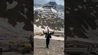
The Caoling Old Trail (aka Caoling Historic Trail) is a section of the Danlan Old Trail connecting Gongliao District of New Taipei to Dali District of Toucheng Township in Yilan. In the past it was an important shipping route for goods from Yilan to Tamsui. Now it is a popular and family friendly hiking route due to its convenient public transportation, slow elevation gain, grassy mountain hills, and great views of the surrounding area. Background: The name Caoling comes from the mang grass (silver Miscanthus flowers 芒草) that grows on the top of the ridge on the east border of Yilan and New Taipei where there are almost no trees. The trail is said to first be made by the Plains Aboriginies to connect their tribes in the mountains of New Taipei. During the Qing Dynasty, the Caoling Old trail was an important part of the Danlan Old Trail (淡蘭古道 which means the road between Tamsui and Yilan), which was split into three paths, and the Caoling Old Trail was on the Northern Path. The Northern Path was the first path created between Yilan and Tamsui, and winded from Mengjia Old Street to Nuannuan, then to Ruifang, and onto Jiufen and Houtong. From Houtong, the road then went to Mudan and then Shuangxi, then went over the Caoling pass to Yilan. During this time, most of the things traded were tea leaves and agricultural goods. Also, it was the main route for Han Chinese immigrants to come to Yilan. In 1867 Liu Mingdeng, the commander general of Taiwan at the time, walked along the Caoling Old Trail and ran into thick fog and evil spirits. Therefore he made two stone tablets: the "tiger" tablet and the Xiongzhenbianyan Tablet to ward off evil sprits and bring good luck. Before the old Caoling Railway tunnel was completed, the last train along the Yilan Railway line stopped at Fulong, and people then walked along the Caoling Old Trail to Yilan. This is part of the reason why the trail is still preserved today. However after the tunnel was completed, people were able to travel to Yilan by train and the trail lost its importance. Later on, provincial highway 2. Now the trail see a fair amount of tourists, especially during mang grass season (from September to October). Hours: 24/7 Price: Free Difficulty: Easy but long. Length: 9.5 KM Elevation Gain: 500 meters Time Needed: Roughly 4-6 hour round trip When to go: If you don't mind the crowds, the best time to go is in Autumn during the Mang Grass season from September to November. Spring will also have nice temperatures but fewer people and no Mang Grass. Other than that, in the summer it can get really hot because there is little shade on the grassy mountain top, and in the winter it can get really cold and windy. How to get there: By Train: Take the TRA to Fulong Station (or Dali Station), the old trail starts from each station. By Car/Scooter: From Taipei, on provincial highway 5 until you reach Keelung, then take provincial highway 2B to Gongliao. If you want to shorten the hike, you can park at Yuanwangkeng Park (遠望坑親水公園), but you will have to turn around once you reach the top. If you start from either of the train stations, you can walk the full 9.5 KM loop and get back to where you started by train. Music: bensound |