♫musicjinni

AlpSenseRely - 3D Kartierung des Hochvogel - 3D mapping of the Hochvogel peak

video thumbnail
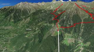
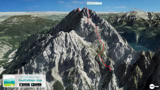
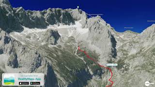
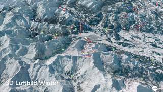
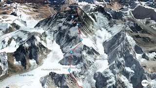
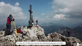
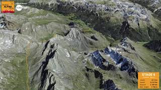
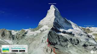
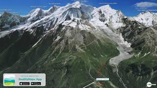
Am Hochvogel (2592 m) im Allgäu droht ein gewaltiger Felssturz. Direkt unterhalb des Gipfel beginnt ein Spalt, der sich in den letzten Jahren bedrohlich erweitert hat. Im Extremfall könnten bis zu 260 000 Kubikmeter Gestein bis zu 1000 Meter tief ins Tal stürzen. Mit Hilfe wiederholter Drohnenbefliegungen wird der Berggipfel hochgenau in 3D vermessen. Mehr dazu: www.realitymaps.de

-----
A massive rock fall threatens on the Hochvogel (2592 m) in the Allgäu. Directly below the summit begins a crevice that has widened threateningly in recent years. In extreme cases, up to 260,000 cubic meters of rock could fall up to 1,000 meters into the valley. With the help of repeated drone flights, the mountain peak is measured with high precision in 3D. More on this: www.realitymaps.de

RealityMaps outdoor app

RealityMaps Outdoor App

App "Mount Everest 3D" by 3D Realitymaps

Mount Everest by 3D RealityMaps

3D RealityMaps - Wandern & Biken auf den Kanarischen Inseln

3D RealityMaps - Hochkönig Mountain Running Marathon

Superski 3D App by 3D RealityMaps

3D RealityMaps - Pistenplan von St . Moritz

3D RealityMaps - Alpiner Skiweltcup 2022 in Schladming

St. Moritz in 3D

3D RealityMaps - Hochmuth Bahn in Meran

RSS GmbH - 3D RealityMaps (Gastgeber)

Watzmann-Überschreitung in 3D

4 Wege auf die Zugspitze und Höllental

RealityMaps Karten: Winter-Sommer-Topo3D

3D model of Munich

Die Streif in 3D

3D model of the historic city center of Landshut

3D Rekonstruktion aus Luftbildern

Highlights der Schweiz

3D model of Amberg

Jost Kobusch - Mount Everest winter solo 2019/2020

3D Cities of Bavaria

AlpSenseRely - 3D Kartierung des Hochvogel - 3D mapping of the Hochvogel peak

TransAlpineRun 2021 - Streckenverlauf

3D model of Burghausen

Golfplatz Ruhpolding

Metaverse: precise localization and AR navigation in an office

Matterhorn über den Hörnligrat

Mont Blanc - Goûter Route (normal route)

Disclaimer DMCA