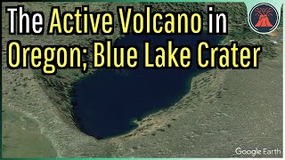
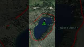
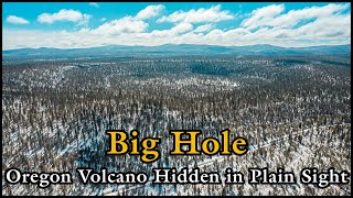
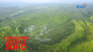
The Active Volcano in Oregon; Blue Lake Crater |

|
|
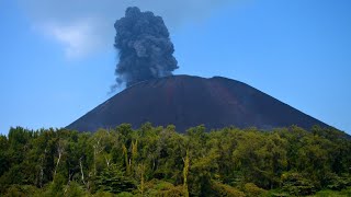
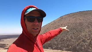
About a millennia ago, a powerful explosive volcanic eruption occurred in the state of Oregon, hurling boulders of rock up to a mile away. As a thick plume of ash rose into the atmosphere, superheated pyroclastic flows incinerated a square mile of forest, starting a wildfire. This sequence of events did not occur at a towering peak such as Mount Hood or the Three Sisters complex, as it instead originated from an often forgotten active volcano known as the Blue Lake Crater. This video will discuss its only known eruption in detail.
Thumbnail Photo Credit: Google Earth. This image was overlaid with text, and then overlaid with GeologyHub made graphics (the image border & the GeologyHub logo). A special thanks to the Extreme Pursuit YouTube channel for granting me permission to use clips of his footage! Video Sources from the Extreme Pursuit YouTube channel: [1] https://www.youtube.com/watch?v=wHaZyx_kIvA Extreme Pursuit channel link: https://www.youtube.com/ExtremePursuit If you would like to support this channel, consider using one of the following links: (Patreon: http://patreon.com/geologyhub) (YouTube membership: https://www.youtube.com/channel/UCYeGh5VML5XPr5jYnzh3J6g/join) (Gemstone & Mineral Etsy store: http://prospectingarizona.etsy.com) (GeologyHub Merch Etsy store: http://geologyhub.etsy.com) Google Earth imagery used in this video: ©Google & Data Providers This video is protected under "fair use". If you see an image and/or video which is your own in this video, and/or think my discussion of a scientific paper (and/or discussion/mentioning of the data/information within a scientific paper) does not fall under the fair use doctrine, and wish for it to be censored or removed, contact me by email at tccatron@email.asu.edu and I will make the necessary changes. Various licenses used in sections of this video (not the entire video, this video as a whole does not completely fall under one of these licenses) and/or in this video's thumbnail image (and this list does not include every license used in this video and/or thumbnail image): Public Domain: https://creativecommons.org/publicdomain/mark/1.0/ Sources/Citations: [1] U.S. Geological Survey [2] J. Ewert, A. Diefenbach, D. Ramsey, "2018 Update to the U.S. Geological Survey National Volcanic Threat Assessment", U.S. Geological Survey, Accessed October 22, 2022. https://pubs.usgs.gov/sir/2018/5140/sir20185140.pdf [3] E.M. Taylor, D.R. Sherrod, M.L. Ferns, W.E. Scott, R.M. Conrey, G.A. Smith, J.L. Ziglet, R.D. Koch, Kathryn Nimz, Taryn Lindquist, Geologic Investigations Map I-2683, U.S. Geological Survey. Note: The above source (source 3) was used to obtain the ash thicknesses (and trace their coverages) as shown in this video. However, the 200 cm thick layer was not sourced from this paper and rather estimated by GeologyHub. [4] Deligne, Natalia & Conrey, Richard & Cashman, Katharine & Champion, Duane & Amidon, William. (2016). Holocene volcanism of the upper McKenzie River catchment, central Oregon Cascades, USA. Geological Society of America Bulletin. 128. B31405.1. 10.1130/B31405.1. [5] VEIs, dates/years, composition, tephra layer name, DRE estimates, and bulk tephra volume estimates for volcanic eruptions shown in this video which were assigned a VEI 4 or larger are sourced from the LaMEVE database (British Geological Survey © UKRI), https://www2.bgs.ac.uk/vogripa/view/controller.cfc?method=lameve, Used with Permission [6] Source of Volcanic Explosivity Index (VEI) methodology and criteria: Newhall, C. G., and Self, S. (1982), The volcanic explosivity index (VEI) an estimate of explosive magnitude for historical volcanism, J. Geophys. Res., 87(C2), 1231–1238, doi:10.1029/JC087iC02p01231. Accessed / Read by Youtube.com/GeologyHub on Oct 5th, 2022. 0:00 An Explosive Oregon Volcano 1:48 Spatter Cones 2:41 Eruption Sequence 3:55 665 CE Eruption Size 4:29 Hazard Rating |