The Potential Future 1,000 Foot High Megatsunami in Alaska; The Barry Arm Landslide |

|
|
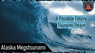
East of Anchorage and north of the town of Whittier is a highly unstable cliff face which is slowly collapsing. Since 2010, this hillside has slid 394 feet but the worst could occur in the future. It is possible that at one point in the short to middle term future, a large section of this hillside will collapse into the water below, generating a megatsunami with a wave height of up to 984 feet or 300 meters. This video will discuss a possible future disaster, which is known as the "Barry Arm Landslide".
Disclaimer: This future tsunami may NOT eventually ever occur, or could theoretically be much smaller than anticipated IF it does occur. This video is meant to warn of a possible but not guaranteed future danger, much like notifying people that they live on a floodplain. The maximum tsunami height mentioned here would be near the origin of a hypothetical large landslide, and would not indicate the resulting height of a wave or run up of water which would be experienced during such an event at population centers in the region. The run-up and wave height at those population centers would be much lower than the initial (maximum) wave height. Updates regarding the ongoing/tsunami threat are found at: https://dggs.alaska.gov/hazards/barry-arm-landslide.html If you would like to support this channel, consider becoming a patron at http://patreon.com/geologyhub. Another way to support this channel is to make an order via our gemstone and geology related etsy store at http://prospectingarizona.etsy.com. This channel's merch store is also on etsy at http://geologyhub.etsy.com. Google Earth imagery used in this video: ©Google & Data Providers Thumbnail Photo Credit: Tim Marshall, @timmarshall, Unsplash, Unsplash license 0:00 A Looming Disaster 0:23 A Moving Hillside 0:46 Maximum Megatsunami Heights 1:45 Recent Megatsunamis in Alaska 2:41 Fjord Landslide Model 3:23 A Summer Disaster? 3:48 Conclusion Creative Commons Licenses used for specific content or sections of specific content (such as a photo within a table) in this video (not the entire video): CC BY 4.0: https://creativecommons.org/licenses/by/4.0/legalcode Sources: [1] Dai, C., Higman, B., Lynett, P. J., Jacquemart, M., Howat, I. M., Liljedahl, A. K., et al. (2020). Detection and assessment of a large and potentially tsunamigenic periglacial landslide in Barry Arm, Alaska. Geophysical Research Letters, 47, e2020GL089800. https://doi.org/10.1029/2020GL089800, CC BY 4.0 [2] National Parks Service, "The 2015 Taan Fiord Landslide and Tsunami" [3] D. Miller, “Giant Waves in Lituya Bay Alaska”, USGS, Geological Survey Professional Paper 354-C [4] Higman, B., Shugar, D.H., Stark, C.P. et al. The 2015 landslide and tsunami in Taan Fiord, Alaska. Sci Rep 8, 12993 (2018). https://doi.org/10.1038/s41598-018-30475-w, CC BY 4.0 [5] Strzelecki, M. C. and Jaskólski, M. W.: Arctic tsunamis threaten coastal landscapes and communities – survey of Karrat Isfjord 2017 tsunami effects in Nuugaatsiaq, western Greenland, Nat. Hazards Earth Syst. Sci., 20, 2521–2534, https://doi.org/10.5194/nhess-20-2521-2020, 2020., CC BY 4.0 |