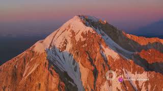
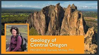
The Active Volcano in Oregon; Mount Jefferson |

|
|
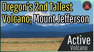
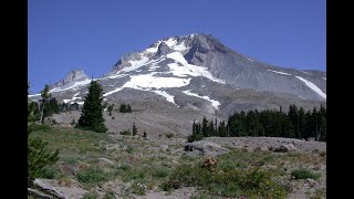
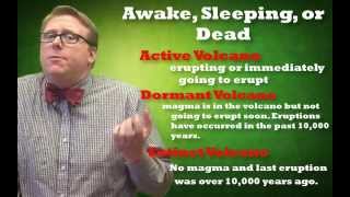
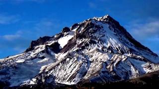
While many people know of Oregon's tallest active volcano (Mount Hood), few people know of its second tallest volcano. And yet, Mount Jefferson, standing at a towering height of more than 10,000 feet above sea level is one day likely to erupt again. This video will discuss Mount Jefferson, its hazards, and its last eruption which occurred only 1,000 years ago.
Thumbnail Photo Credit: "Mt. Jefferson in Central Oregon", 2012, by: Jeff Hollett, Posted on Flickr, Image link: https://www.flickr.com/photos/jeffhollettvancouverwa/38735809754/, Public Domain. A special thanks to the Extreme Pursuit YouTube channel for granting me permission to use clips of his footage! Video Sources from the Extreme Pursuit YouTube channel: [1] https://www.youtube.com/watch?v=wHaZyx_kIvA Extreme Pursuit channel link: https://www.youtube.com/ExtremePursuit If you would like to support this channel, consider using one of the following links: (Patreon: http://patreon.com/geologyhub) (YouTube membership: https://www.youtube.com/channel/UCYeGh5VML5XPr5jYnzh3J6g/join) (Gemstone & Mineral Etsy store: http://prospectingarizona.etsy.com) (GeologyHub Merch Etsy store: http://geologyhub.etsy.com) Google Earth imagery used in this video: ©Google & Data Providers This video is protected under "fair use". If you see an image and/or video which is your own in this video, and/or think my discussion of a scientific paper (and/or discussion/mentioning of the data/information within a scientific paper) does not fall under the fair use doctrine, and wish for it to be censored or removed, contact me by email at tccatron@email.asu.edu and I will make the necessary changes. Various licenses used in sections of this video (not the entire video, this video as a whole does not completely fall under one of these licenses) and/or in this video's thumbnail image (and this list does not include every license used in this video and/or thumbnail image): Public Domain: https://creativecommons.org/publicdomain/mark/1.0/ CC BY 2.0: https://creativecommons.org/licenses/by/2.0/legalcode Sources/Citations: [1] U.S. Geological Survey [2] J. Ewert, A. Diefenbach, D. Ramsey, "2018 Update to the U.S. Geological Survey National Volcanic Threat Assessment", U.S. Geological Survey, Accessed October 22, 2022. https://pubs.usgs.gov/sir/2018/5140/sir20185140.pdf [3] VEIs, dates/years, composition, tephra layer name, DRE estimates, and bulk tephra volume estimates for volcanic eruptions shown in this video which were assigned a VEI 4 or larger are sourced from the LaMEVE database (British Geological Survey © UKRI), https://www2.bgs.ac.uk/vogripa/view/controller.cfc?method=lameve, Used with Permission [4] Source of Volcanic Explosivity Index (VEI) methodology and criteria: Newhall, C. G., and Self, S. (1982), The volcanic explosivity index (VEI) an estimate of explosive magnitude for historical volcanism, J. Geophys. Res., 87(C2), 1231–1238, doi:10.1029/JC087iC02p01231. Accessed / Read by Youtube.com/GeologyHub on Oct 5th, 2022. 0:00 Oregon's 2nd Tallest Volcano 0:17 Mount Jefferson 0:47 Geologic Setting 1:54 Eruptive History 3:15 Recent Eruptions 4:27 Hazard Rating |